
I had a big day on the calendar early in September – a choose your own adventure triathlon I put together with a buddy. Our goal was to ride from the low point of Minnesota and summit all the 5 high points in one go. The 5 highest points in Minnesota are all north-ish of Grand Marais. The 4th highest and highest points have trails to the top, while the other 3 points have no maintained trail, and based upon what I could find online (and our experience in trying to summit them), do not appear to be summitted very often.
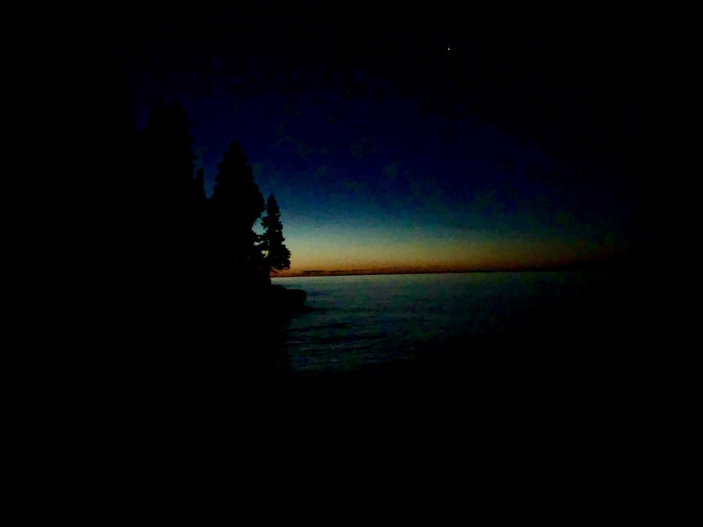
We chose several aspects of the planned route based upon aesthetics. We chose to use as a starting point the place where the Cascade River empties into Lake Superior, since the shore of Lake Superior is the state’s low point. That way, we’d traverse from the state’s lowest point to highest. And there is a state campground right there off the river, which makes for a good base camp for the weekend.
We also decided to tackle the high points in order from 5 to 1, which first and foremost made the most efficient route, but it also was nice summitting them in order of shortest to tallest. That also meant that we’d hopefully complete the summits that required bushwhacking during daylight. If we had to, we could summit Eagle Mountain by headlamp – it had the best maintained trail of the bunch.
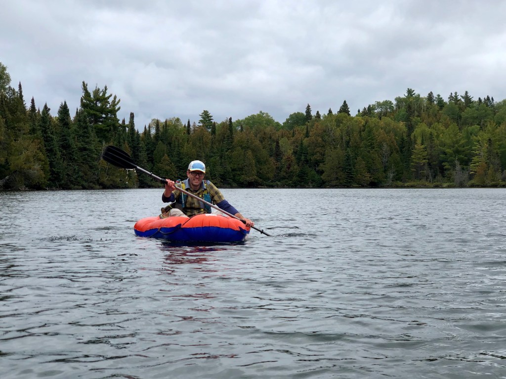
To cut down on sheer number of miles, we decided to buy some inexpensive inflatable kayaks so we could cross a short bit of lake that separated one bit of road from another. Some time back, this stretch had a bridge crossing it, but all that is left now are several rotting supports jutting out of the lake. Paddling across this part would save us a good 20-30 miles of riding and we knew this would be an invaluable time and energy save, even though it required carrying another 5-ish pounds of gear. After scouting the 3rd highest point a bit earlier this summer, the Misquah Hills high point, we elected to also use these rafts to paddle in towards the Misquah Hills due to its remoteness. It looked like a very tough 8-10 miles by foot, based upon the maps and satellite images we referenced. The only beta I was able to obtain from a person that actually summited this point by foot involved for him a 16 hour bushwhack, which was a no-go for this magnitude of the day we already had planned.
We set up camp at Cascade River State Park the night before and headed into Grand Marais to grab a bite to eat at Voyager Brewing. They seem to have some solid beers – I really enjoyed the IPA I had. Then we headed back to camp to try to get some rest for a 4am wakeup. I started second guessing this time at some point in the night, as I didn’t think it gave us a realistic shot of getting all the summits, but it was an okay balance of trying to get proper rest, and an ensuring an early start. In hindsight, I don’t we could have risen early enough to tackle this whole idea in a day, at least with the gear we carried and the limited prior route knowledge we had.
After a couple hours of good sleep and a couple more of fitful rest, I got up at 3:15 and started making some coffee and breakfast. The morning was putz-y enough with getting gear dialed in on the bikes that it took us until about 5 to get butts on bikes, so I was happy to have awoken a little early. At that point, we headed down to Lake Superior for the official starting point (in as much as a personally chosen starting point can be official, I guess).
The short: we successfully summitted #5 (2210’), #4 (Lima), & #1 (Eagle). We turned back on the Misquah hills high point (#3), and 2266’ (#2). We were moving for about 11 ½ hours with a total of 15 ½ hours total elapsed time with the transitions and stops to reference gps/maps.
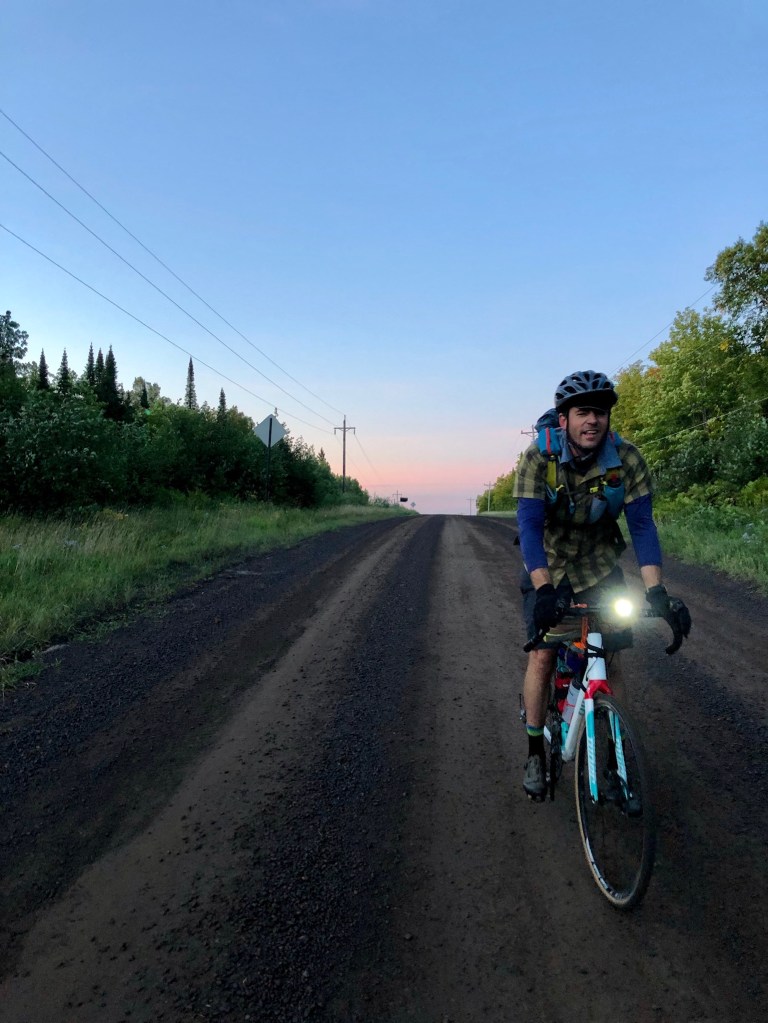
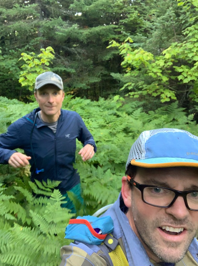
The long: we started pedaling along 61, heading east from the Cascade River, getting a short warm up pedal before our first climb of the day. The next few miles were mostly uphill, with some solid grades at certain points, then some generally uphill gravel, but more rolling hills than sustained climbs. We reached the first transition point in about 2 hours and 50 minutes. With about 40% of the day’s biking complete, started bushwhacking up to Point 2210’. 2210’ went quite easily, especially considering it in hindsight after our experience on 2266’. We were able to find some clearings with tall ferns that we could walk through. These clearings were peppered throughout the forest here, and we linked up several to find the high point. We made good time bagging this one, I think it only took us 36 minutes of moving roundtrip, including some time spent settling on the right point after referencing a gps and scouting various rises in the woods.
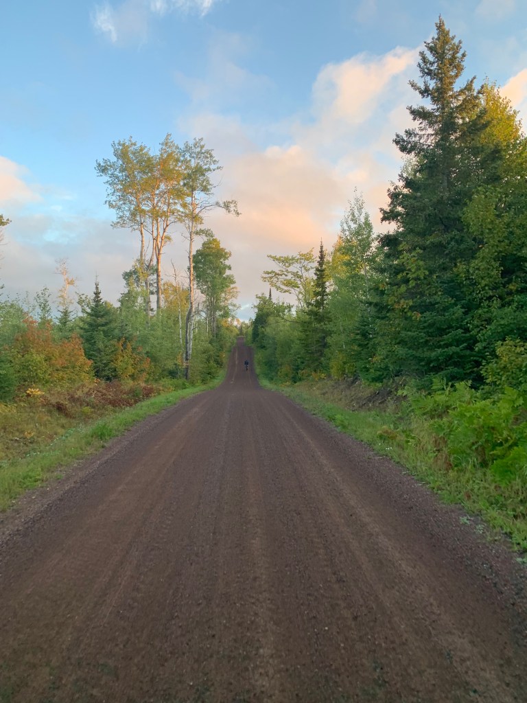
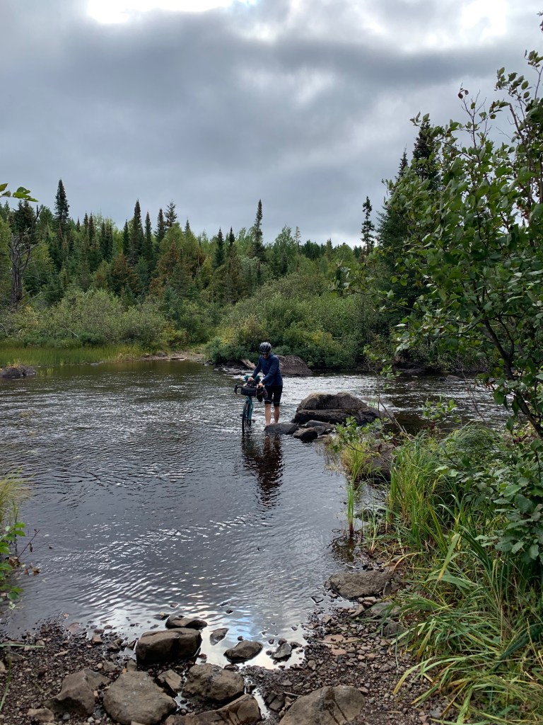
The bike over to and jog/hike up Lima went fine. I was fully awake at this point and enjoying the effort. We had one river crossing and some short stretches of road that were a little more techy, which required that we pick a line through the rocks and variable surface. Our only mechanical issue of the day came through this stretch, wherein my saddle popped off the seatpost. Fortunately, the nut that attaches the seat post clamp stayed with the saddle, and we were moving again within about 10 minutes. I did notice that the wind had been consistently stronger this morning than I would have liked given the paddle that lay ahead in our extremely lightweight watercraft. I hoped it would die down by the time we got there. Lima has a trail the whole way – it is overgrown, but it is easy to follow the trail all the way to the summit so we made quick work of this one too.
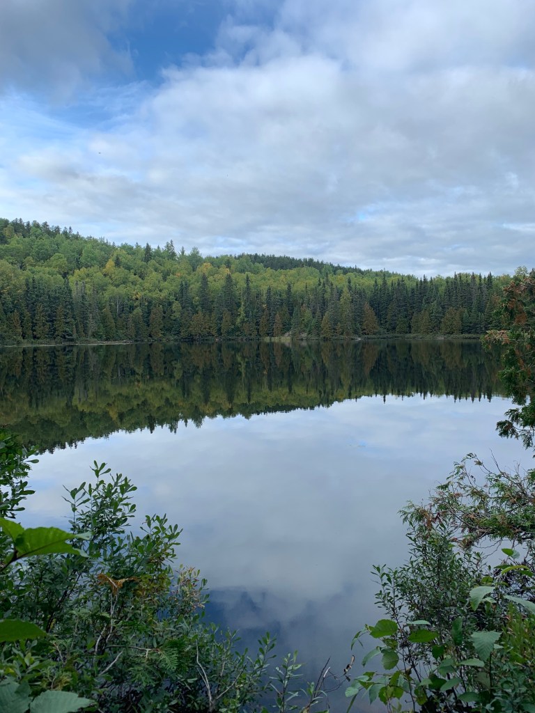
From Lima, we had a short bike to the Ram Lake BWCA entry point. Ram Lake’s entry point to the BWCA starts with an uphill 1/3 mile portage to start in order to reach the lake. The Misquah Hills high point is really the crux of this trip. There is no clear way to get to this high point. We took a scouting trip earlier in the summer. Based upon that trip and the beta we uncovered through some research, we decided it would be best to paddle along the Boundary Waters route that goes from the Ram Lake entry point, through 4 lakes, to the west side of Little Trout lake. Then we could bushwhack up to the high point from there, which looked to be maybe 3 miles round trip from the west of Little Trout. This seemed like the best route, especially considering what we found out about doing it all on foot.
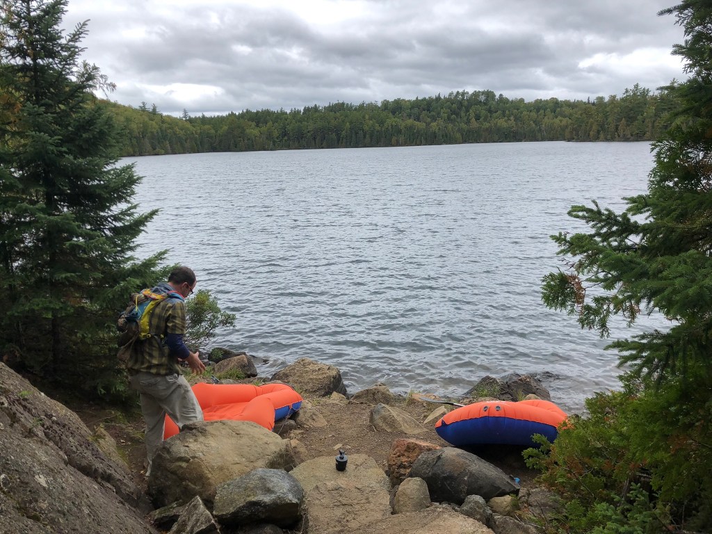
However, after paddling across Ram Lake, we both got the sense that timely success was unrealistic given the more minimalist approach we took. The paddling was slow going, and for me, basically a novice paddler, it was a struggle, working muscles I don’t usually use. With the lower cardiovascular effort involved in the paddling small watercraft and water getting into the dinghies and soaking us a bit, we were already getting cold. After talking it through while we walked the first portage, we made a solid decision to concede that summit. With our small inflatable rafts, the Misquah Hills high was just too risky- if something went wrong in our little dinghies, it’d have gotten serious quickly. It would have taken a lot to walk back around Ram Lake to get back to our bikes and we’d be wet and cold the whole time and who knows how that would have gone down. So we turned around and paddled back across Ram Lake to our bikes to try the next point. 4 out of 5 would be a good effort, we figured.
We repacked the bikes and made the short pedal over to our chosen starting point for point 2266’. The bushwhacking on 2266’ was thick and, unlike 2210’, no natural weakness revealed itself in the entire time we were out there. In short, that was the most soul crushing bushwhacking I’ve ever done. It took almost an hour to cover a mile, and we had only made it ½-mile towards the summit. We wanted to leave time for Eagle and not be in the dark at the end of a long day for too too long. Plus the bushwhacking was starting to stress me out – this is likely an area that rarely sees a human foot and my fatigue was shaking my confidence. So we turned back. This turned out to be another good decision – we at least were able to ride to, summit & descend Eagle, and cover some of the ride back from Eagle in daylight, which minimized unreasonable risks.

Pulling into Eagle was almost a shock – we were suddenly at a trailhead with half a dozen cars at it, after not seeing a single person for the last few hours (there were two fishermen camping on Ram Lake that we said hi to maybe 6 hours prior, but I don’t think we saw anyone after that). The top of Eagle is about 6.5 miles round trip by foot from the trailhead. I think we both figured we could manage a jog for most of this trail since it is well maintained and travelled often. The trail is very technical, however, with roots and rocks prohibiting us from getting into a rhythm. We jogged short bits only to be slowed to a brisk hike by the obstacles along the trail. It didn’t help to be 12 hours into the day – I was not very sure footed at that point. It would be a little more runnable fresh. It took right about 2 hours round trip. Regardless, it was nice to be on a trail and be able move with our minds more or less on auto pilot, with no navigation or long-term decision making to think about.
We hopped back on the bikes for one last push after getting back to the trailhead. I thought the bike back to Cascade River State Park would be more downhill than it felt. But there were bumps to climb that had me in granny gear, really feeling the effort of the day. I was probably pretty low on fuel at this point – I did an okay job eating along the way, but in typical fashion ate less and less as the day progressed. I was also getting some nerve paid in my left foot and my 3 smallest toes were firing off pretty bad with burning and pain. I loosened my shoes and gritted through the little hills.
At one point after dusk and when my foot pain reached a crescendo, I yelled out loud “Fuck you.” Within maybe a hundred feet, I passed an opening in the woods on the right and saw two guys armed and dressed in full camo just standing there. It definitely startled me. I said “hey,” hoped they didn’t think my obscenities were directed their way, and kept pedaling.
It was nice to get back to pavement 15-20 minutes later and finally be on a true downhill, though not so nice to have cars buzzing by in the dark at 50+ miles an hour. I could finally smell the barn and wanted to cover these downhill miles quickly, but also wondered about the chance some deer would jump out into the road in front of me. Fortunately, if any deer were lurking on the side of the road, they stayed put.
We ended up covering about 77 miles on the bike, and maybe 12 hiking/jogging/extreme bushwhacking, and not quite 2 miles of paddling in around 15 ½ hours. The bike portion took under 6 hours, so the rest of the trip was very time consuming between the route finding and transitions. Tough ass day, but a good experience with a mix of challenges. Technically a failure in that we didn’t summit all 5 points, but a success in so many ways.
While a nice route and there is a lot about this idea that I like, I’m not sure this is a realistic endeavor in one push. It depends upon how quickly one could make points 2 & 3 go with proper scouting and equipment. I think if one were to do the 2nd and 3rd highest point, you’d want to already have done them so you had a sense of the most efficient route to each. Maybe even do a little pruning in spots. And I also think you’d want to stash a canoe at Ram Lake so you can make good time across the 4 lakes, and take some of the risk out of going that remote in the middle of a really big day. Or maybe splurging on some really solid packrafts that you could carry on a bike, if fully unsupported is your jam.
