This summer had a frenetic pace, with travel every couple of weeks. I planned again on getting to the Winds with my friend Bryce, which was the big one for the year. We managed to get there this year, fortunately. I also spent time in Montana. We booked the annual trip to the Maxey cabin during the same week that the Bridger Ridge Run was scheduled to take place, so I entered the lottery and was granted the opportunity to run that again, nine years after my last trip along the ridge. The Montana trip was a couple short weeks after the Winds trip, so my fitness was very general (30+ miles of hiking in the Winds with big packs). However, the time at altitude definitely carried over.
The Wind River Range was amazing. Such a beautiful, remote place. We flew into Jackson, then after a couple stops for supplies, drove to Pinedale for some final provisions and up to the trailhead. I could feel the altitude from the get go. The hike into our objective, Ellingwood Peak, is about 15 miles total, but starts very gradually. There are only a couple steeper climbs the whole way- you only gain about 2000′ net vertical (after some downs) over the 15 miles.
We started around 2:30 pm or so and hiked 1/2 way that day, then finished up the hike the next morning. We stopped at Island Lake the second day for a bit, and ate food and enjoyed the view. We were in no great rush on day 2, since we’d be waiting to climb the ridge until the next morning.
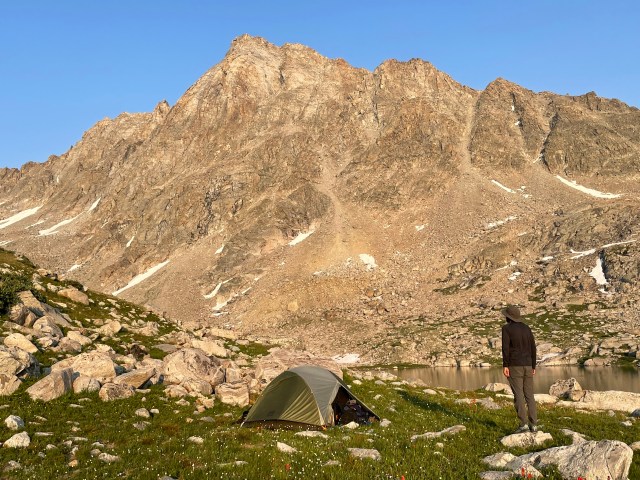
We set up camp in an alpine meadow near Lake 10,800′. Beautiful spot.
Below Ellingwood Peak in the Wind River Range, at about 11,000 feet
The plan was to get up before dawn the next day and be on the climb at dawn, but our bodies seemed to have other plans. Bryce had a solid altitude headache, while my body didn’t seem to like processing the high fiber dinner of quinoa and black beans at altitude. Our alarm went off and we’d felt like we hadn’t slept a wink, so we decided to give it a bit. After giving ourselves a pass on the early start, we moved pretty slowly and started heading up to the base of the climb about 3 hours later than planned. This delay would likely put us in harms way of any afternoon storms, should they materialize.
We decided we’d see what our pace was like and then make a call depending upon that pace . I led the first pitch — my first trad lead of the year, no less. It was pokey, but felt like I got back in the groove of placing gear efficiently by the end of the pitch.
Even so, we needed to be moving about twice as fast as we were in order to put the summit in sight at a reasonable time of day. The weather looked pretty solid, but we couldn’t be sure that we’d avoid an afternoon storm if we continued on. So we elected to rap off before we got too committed (retreat gets less feasible higher on the route). I think my body thanks me — I felt really beat up just from easy effort at that altitude for that long, and the walk out was a bit of a slog for me.
I definitely want to go back there, but maybe without lugging all that climbing gear. I would like to climb there again, but I didn’t feel strong enough mentally for it. Seemed like I was fighting a voice in my head the whole time, just wanting to be back home. Committing experiences climbing in remote areas are probably in my rear view mirror at this point. But moving light and fast, making long day trips, seem realistic still.
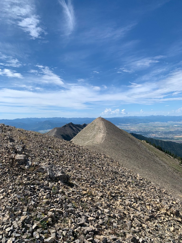
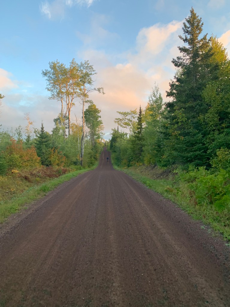
It was a fun few days catching up with friends at the Maxey cabin. Got some shorter hikes and bike rides in. The Ridge Run went well enough, made good time for me through mile 14 or so, then had to take it pretty easy on the final long 4+ mile descent to the finish as my knee was flaming out. Lost close to an hour through those last miles, but thanks to wiser pacing, still beat my time from 9 years ago (where I blew up pretty bad due to lack of experience).
view down the last several miles of the Bridger Ridge Run
Its a great event, always glad to take part.
I’d love to type more about the fall, but this post has been sitting on my computer for weeks now, and its now the new year, so I guess I’ll leave it there. Have some thoughts I’d like to hammer out on this platform, so hopefully I can make writing more of a habit!
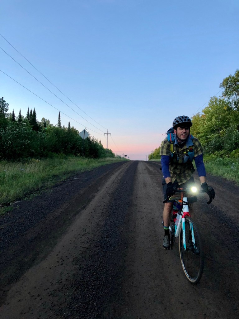
So the Winds didn’t happen, unfortunately. I ended up spraining my ankle 2 days before the trip chasing after our new puppy. My friend Bryce and I were already committed to flying out to Salt Lake City, so we came up with a decent plan B — the City of Rocks in Idaho. Good car camping and the chance to climb without having to hike 20+ miles roundtrip with 50 pound packs on our backs. Even if my ankle wouldn’t cooperate, we could chill and drink beer.
With the help of ice, compression and some Vitamin I, we were able to climb a bit, though we had to keep it super easy. The highlight was probably climbing Theater of Shadows on Jackson’s Thumb, a 4 pitch 5.6ish clip-up. Fun movement and great views.
Top of the Theater of Shadows at an unshadowy time of day
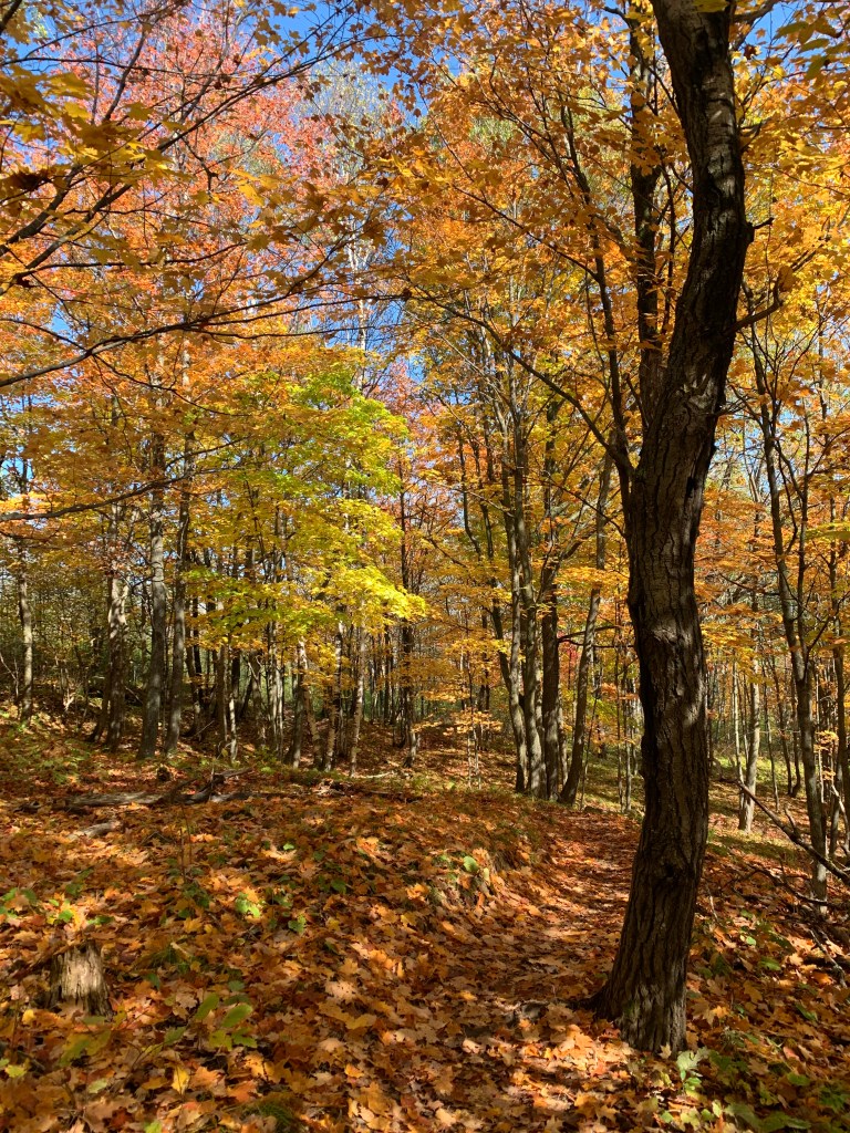
I’ve been nursing the ankle most of the fall. Went to an ankle guy, who diagnosed as a high ankle sprain, which of course takes longer to heal. Biking has been mostly fine. If I land funny mountain biking, I’ll get a zinger. Its been a great fall for biking in Minnesota.
A nice fall ride in Duluth on the Piedmont & Brewer trails
I did have a Ragnar Trail Relay on the calendar in September which I couldn’t really train for. But I sort of felt like the 3 other guys were depending on me to show up, so I went and covered my 30 miles over the course of the 20+ hours it took our team – 6 legs of 3 to 7 miles each. I walked the majority of the event, but got ‘er done. It rained really hard for part of the night which made the laps in the middle of the night pretty sloppy, but I think we all thought it was a pretty cool experience overall. Solid crew.
Its a place I’ve always wanted to get to — I bought the Climbing and Hiking guidebook for the Winds in 2007. I finally have a trip on the books for this summer. Me and a buddy are heading to Titcomb Basin, with the plan to climb an easier route on Ellingwood (or Harrower, if you’re looking at a USGS topo) Peak. And perhaps tick another route or peak depending upon weather and logistics — it will be a quick trip for what it is.
Titcomb Basin, or more accurately, Island Lake where we will be staying for a couple nights, is at over 10,000 feet in elevation and about 12 miles from the nearest trailhead. (Titcomb is closer to 15 miles in). I imagine we’ll each be carrying near 50 pounds on the hike in, between camping gear and provisions and climbing gear.
I am peppering into my weekly activities a little more bouldering, and will be hiking with weight (currently using 25#) at least once a week for now. Since its nothing too technical, I just need to prep my body to deal with the extra weight I’ll be carrying in, and for a moderate endurance effort at altitude.
I will still be biking a bunch for the next month, and will always be drawn towards days on the mountain bike. I won’t fight that urge even in July and August, but will try to focus on putting in some specific work to be as prepared as possible, so we can be successful in the backcountry of the Winds. Getting pumped!
Well it seems like I sit down to write a bit about what’s going on, and never get around to finishing any notes sufficient to share on here. Obviously recreational activities have not gone as planned in the past year, with the impact of the coronavirus pandemic. Now more than ever, local, suburban adventure is about what I (and most others) can do. I haven’t really put together too many proper adventures in the past year for various reasons, but I have consistently been putting my butt on the bike. And I have managed to eke out a few memorable outings here and there.
One such outing was to drink beer and hang with a couple friends in August. We met at a brewery north of downtown Minneapolis, then completed a 40-some odd mile tour to a couple breweries and to eat tacos at Colita.
Otherwise, I have found creative ways to find unique experiences out my front door. Or, in one instance at least, that experience is now in my backyard. I built a bouldering wall late fall.
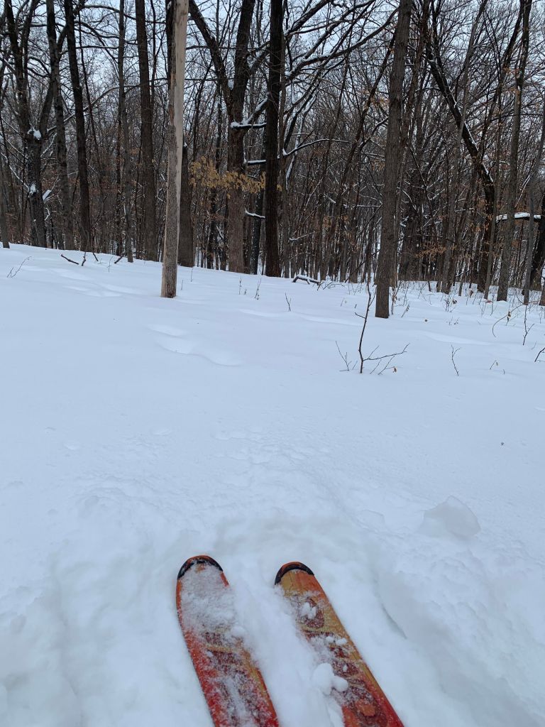
I also picked up a new set of alpine touring ski boots this winter. My resort ski boots have become akin to medieval torture devices. I found a good light boot on sale that is quite comfortable. My kids are starting to ski, so it will be nice to have a boot I can hang out in comfortably while I ski with family. But an added bonus is that they are good for touring, too. I started doing short tours up the road at a preserve that has a little (very little) vertical relief.
Nice woods up the road for brief ski tours
I figured I’d try it once and that it would probably be a pain in the ass, with too many transitions from uphill to downhill. And yes, that part is a pain, but it proves to be a good recovery type day, where I can get my heart rate up a little during a low impact activity. The woods are beautiful, so its nice to just get out and mix it up. So I’ve been doing that maybe once every other week or so since.
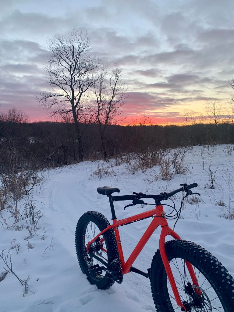
I have been pretty good about getting out on the fat bike this winter so far. We’re in the deep freeze now with most of the rest of the country. I have my winter gear pretty dialed, so feel comfortable getting out even if its sub-zero.
Lovely Sunrise on the Fat Bike
So, that’s it for now – just wanted to put something out here. I hope to get some proper adventures in this year. Only plan is Lutsen at the end of June for now.
I managed to squeeze in a bike commute this week to check the box for January. Conditions were quite good for the time of year. I rode my Niner RLT and encountered very little ice on the roads, so it was only 10-15 minutes slower than it typically is during the summer. It was about 24 degrees for the start of the ride home on Tuesday and 16 degrees on the ride in the next morning. Very little wind both ways with a few flurries. I took the most direct route to/from the express bus, which ends up coming in right at 15 miles each way.
These commutes are a nice way to infuse a little adventure into the weekly grind. Riding into the city in dimming light and in light snow had a nice feel to it. Getting ready takes longer, but I still managed to make the bus that I hoped to ride from downtown to home. I picked up a new rear tail light for my bike this fall, the Knog Blinder, and it gives me a lot of confidence that I am being seen on roads in the winter. Bright with some good flashy settings and the battery is long lasting, even in the cold.
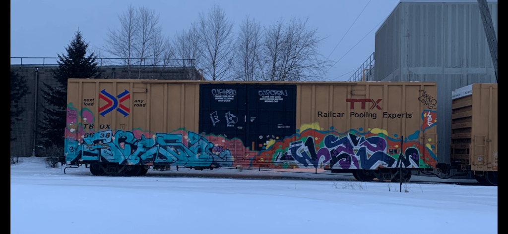
There’s a place close to my work where train cars that have been tagged with graffiti get parked, presumably for removal of the graffiti. But there can be some pretty cool graffiti awaiting removal that I can check out more closely when commuting by bike:
I’m starting to put some thoughts into structuring some activities for 2020. I haven’t really solidified much yet other than riding my bike at Lutsen at the end of June. That event has become a nice long weekend with the family that includes a timed bike event for me, and some fun kids’ events the day after on Sunday morning.
I have not ridden Lutsen’s showcase distance, the “99er” yet. I’ve ridden the “69er” the past two years, and the “39er” the year before. I’m hoping to get the training in for the 99er this year, but if the training doesn’t come together, I will likely ride the 39er, which I think is actually more like 45 miles now. Pretty sure they even dispensed with the “niner” designation last year based upon some slight course changes.
I have some other thoughts about events or objectives, but I haven’t really settled on anything specific. Last year, the high points adventure was the focus, and it was a nice objective with the type of aesthetics I’m drawn to. Without another objective like that, part of me thinks another go at that would be worthwhile. Though I don’t have a great desire for the bushwhacking. Doing Minnesota’s low point to high point might be a nice option for a focused harder mid-length effort.
I also have a little itch to try a longer distance on foot. I have done several 50k events in past years, so 50 mile is the next distance that is commonly offered in the ultra world. 50k has typically stretched me fairly thin though. I’m injury prone when it comes to running, so I don’t know that I can absorb the training necessary to get fit for a 50 mile. An 8 hour race could be a good alternative, where I can cover more than 31 miles and see how that goes. The only event I have in mind on that front is the Icebox 480 as of right now. That isn’t until early November.
I could also just focus on some local-ish fkt that has yet to be established. I have been eyeing up the Sioux-Hustler trail, which is a nice 50k lollipop in northern Minnesota. This discussion is a long way of saying I’m unsettled on the events/objectives front.
I do have a goal to commute more by bike. My bike commute is 29 miles one way, so I typically take the bus downtown, then ride to work from there. Then its 15 miles. To ease the time commitment of bike commuting, I often ride home from work, leaving my car at work, then ride in the next morning. My goal this year is to commute round-trip at least once in every calendar month, and to have 100 total one way trips, or to commute 50 days. So I’ll be keeping an eye out for a good window in January to start 12 months of commutes, where its not super cold and the roads are either clear, or at least predominately packed snow instead of ice.
I want to post more here, too. Making a habit of writing is important for me. Recognizing that no one really visits this blog yet, and that I have no interest in sharing or promoting my own content, I’m still going to make more of it. I also got a GoPro for Christmas, so if I can get decent using that thing, I may link a video or two. Cheers! Happy New Year.
I had a big day on the
calendar early in September – a choose your own adventure triathlon I put
together with a buddy. Our goal was to ride from the low point of Minnesota and
summit all the 5 high points in one go.
The 5 highest points in Minnesota are all north-ish of Grand Marais. The
4th highest and highest points have trails to the top, while the
other 3 points have no maintained trail, and based upon what I could find
online (and our experience in trying to summit them), do not appear to be
summitted very often.
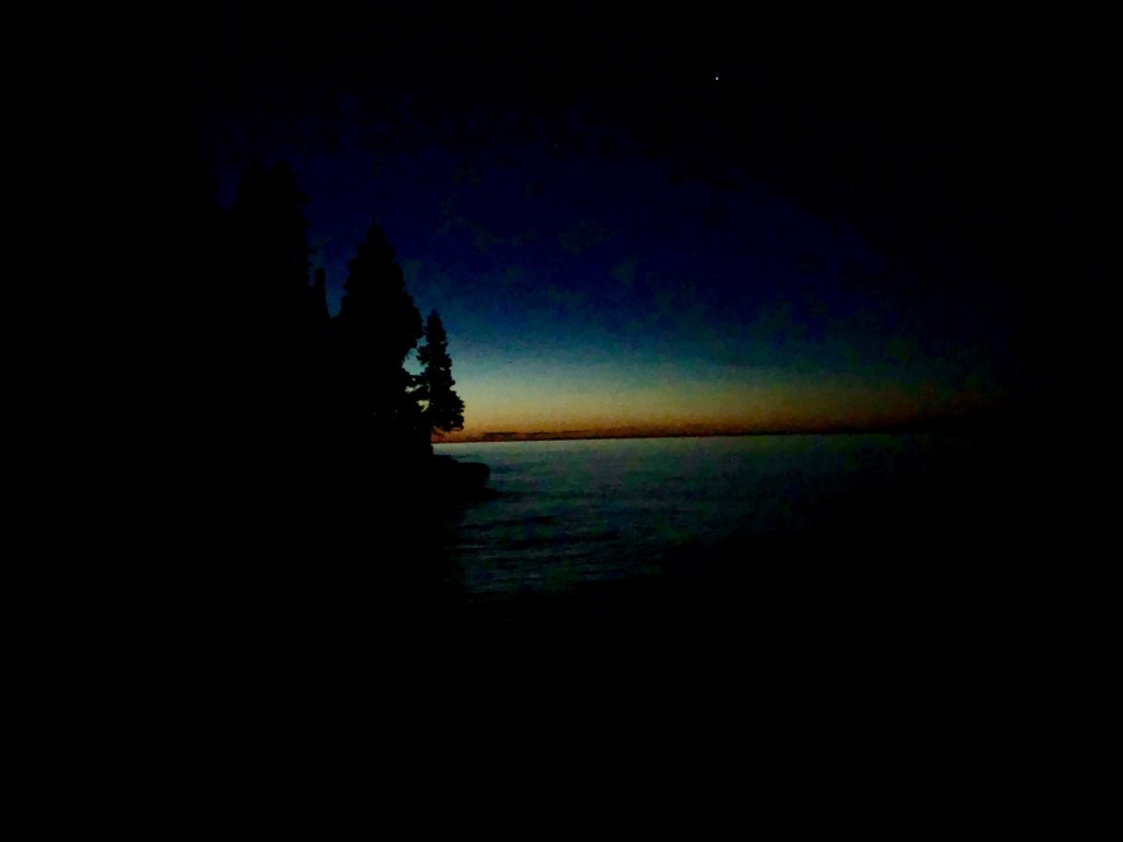
Pre-dawn glow on the edge of Lake Superior
We chose several aspects
of the planned route based upon aesthetics.
We chose to use as a starting point the place where the Cascade River
empties into Lake Superior, since the shore of Lake Superior is the state’s low
point. That way, we’d traverse from the state’s lowest point to highest. And there is a state campground right there
off the river, which makes for a good base camp for the weekend.
We also decided to tackle
the high points in order from 5 to 1, which first and foremost made the most
efficient route, but it also was nice summitting them in order of shortest to
tallest. That also meant that we’d hopefully
complete the summits that required bushwhacking during daylight. If we had to,
we could summit Eagle Mountain by headlamp – it had the best maintained trail
of the bunch.
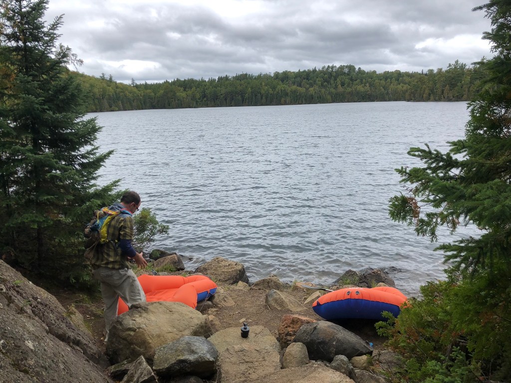
To cut down on sheer number
of miles, we decided to buy some inexpensive inflatable kayaks so we could
cross a short bit of lake that separated one bit of road from another. Some
time back, this stretch had a bridge crossing it, but all that is left now are
several rotting supports jutting out of the lake. Paddling across this part would save us a
good 20-30 miles of riding and we knew this would be an invaluable time and
energy save, even though it required carrying another 5-ish pounds of gear. After scouting the 3rd highest
point a bit earlier this summer, the Misquah Hills high point, we elected to also
use these rafts to paddle in towards the Misquah Hills due to its remoteness. It
looked like a very tough 8-10 miles by foot, based upon the maps and satellite images
we referenced. The only beta I was able to obtain from a person that actually summited
this point by foot involved for him a 16 hour bushwhack, which was a no-go for this
magnitude of the day we already had planned.
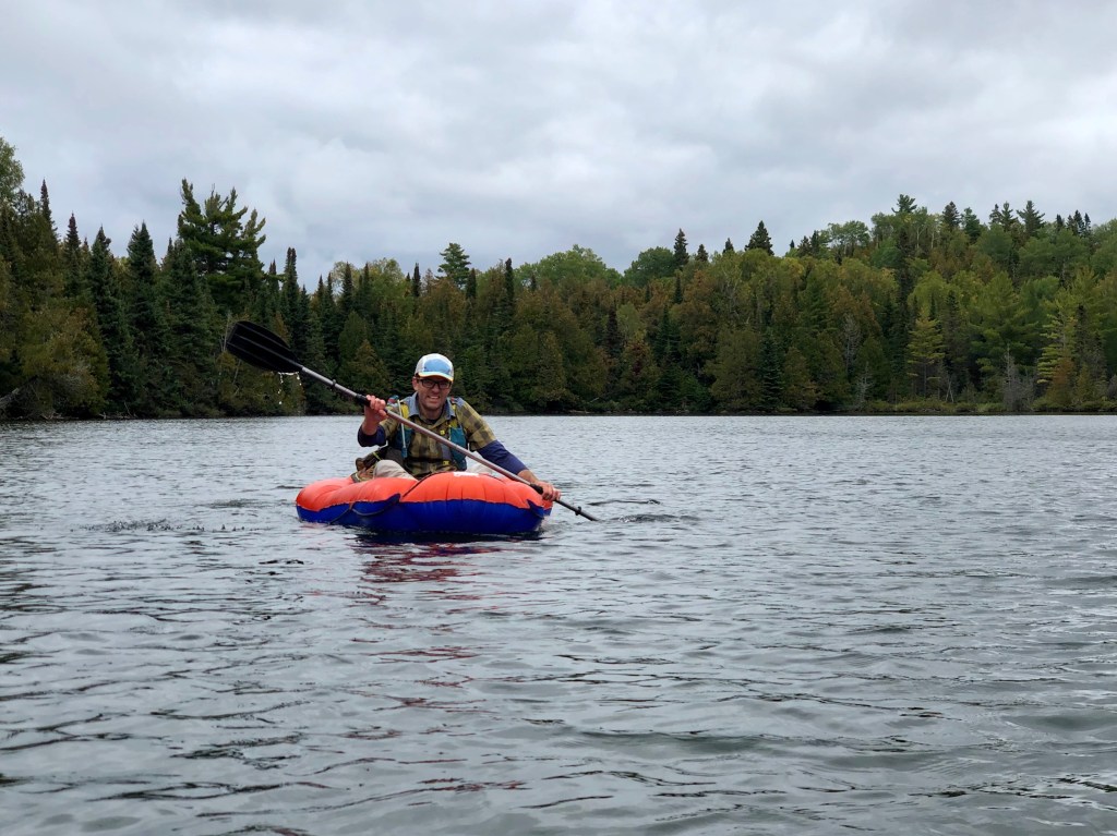
My best inflatable Kayak grimace
We set up camp at Cascade
River State Park the night before and headed into Grand Marais to grab a bite
to eat at Voyager Brewing. They seem to have some solid beers – I really enjoyed
the IPA I had. Then we headed back to camp to try to get some rest for a 4am
wakeup. I started second guessing this time at some point in the night, as I
didn’t think it gave us a realistic shot of getting all the summits, but it was
an okay balance of trying to get proper rest, and an ensuring an early start. In hindsight, I don’t we could have risen early
enough to tackle this whole idea in a day, at least with the gear we carried
and the limited prior route knowledge we had.
After a couple hours of good
sleep and a couple more of fitful rest, I got up at 3:15 and started making
some coffee and breakfast. The morning was putz-y enough with getting gear
dialed in on the bikes that it took us until about 5 to get butts on bikes, so
I was happy to have awoken a little early.
At that point, we headed down to Lake Superior for the official starting
point (in as much as a personally chosen starting point can be official, I
guess).
The short: we successfully summitted #5 (2210’), #4 (Lima), & #1 (Eagle). We turned back on the Misquah hills high point (#3), and 2266’ (#2). We were moving for about 11 ½ hours with a total of 15 ½ hours total elapsed time with the transitions and stops to reference gps/maps.
Sun rising, I think the bigger climbs behind us
The long: we started pedaling
along 61, heading east from the Cascade River, getting a short warm up pedal
before our first climb of the day. The
next few miles were mostly uphill, with some solid grades at certain points,
then some generally uphill gravel, but more rolling hills than sustained climbs.
We reached the first transition point in about 2 hours and 50 minutes. With about
40% of the day’s biking complete, started bushwhacking up to Point 2210’. 2210’ went quite easily, especially
considering it in hindsight after our experience on 2266’. We were able to find some clearings with tall
ferns that we could walk through. These clearings were peppered throughout the
forest here, and we linked up several to find the high point. We made good time bagging this one, I think it
only took us 36 minutes of moving roundtrip, including some time spent settling
on the right point after referencing a gps and scouting various rises in the
woods.
Beautiful Gravel riding Fern-whacking
The bike over to and
jog/hike up Lima went fine. I was fully awake at this point and enjoying the effort.
We had one river crossing and some short stretches of road that were a little
more techy, which required that we pick a line through the rocks and variable
surface. Our only mechanical issue of
the day came through this stretch, wherein my saddle popped off the seatpost. Fortunately,
the nut that attaches the seat post clamp stayed with the saddle, and we were
moving again within about 10 minutes. I
did notice that the wind had been consistently stronger this morning than I
would have liked given the paddle that lay ahead in our extremely lightweight
watercraft. I hoped it would die down by the time we got there. Lima has a trail the whole way – it is
overgrown, but it is easy to follow the trail all the way to the summit so we
made quick work of this one too.
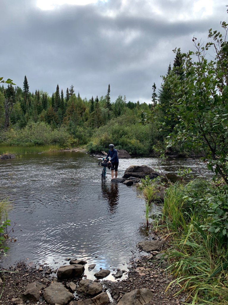
River crossing- the [Minnesota] Brule, I think
From Lima, we had a short
bike to the Ram Lake BWCA entry point. Ram Lake’s entry point to the BWCA starts
with an uphill 1/3 mile portage to start in order to reach the lake. The Misquah
Hills high point is really the crux of this trip. There is no clear way to get
to this high point. We took a scouting
trip earlier in the summer. Based upon that trip and the beta we uncovered
through some research, we decided it would be best to paddle along the Boundary
Waters route that goes from the Ram Lake entry point, through 4 lakes, to the
west side of Little Trout lake. Then we could bushwhack up to the high point
from there, which looked to be maybe 3 miles round trip from the west of Little
Trout. This seemed like the best route,
especially considering what we found out about doing it all on foot.
Getting ready to put in at Ram Lake
However, after paddling
across Ram Lake, we both got the sense that timely success was unrealistic
given the more minimalist approach we took. The paddling was slow going, and for me, basically
a novice paddler, it was a struggle, working muscles I don’t usually use. With the lower cardiovascular effort involved
in the paddling small watercraft and water getting into the dinghies and
soaking us a bit, we were already getting cold.
After talking it through while we walked the first portage, we made a
solid decision to concede that summit. With
our small inflatable rafts, the Misquah Hills high was just too risky- if
something went wrong in our little dinghies, it’d have gotten serious quickly. It would have taken a lot to walk back around
Ram Lake to get back to our bikes and we’d be wet and cold the whole time and
who knows how that would have gone down. So we turned around and paddled back across
Ram Lake to our bikes to try the next point. 4 out of 5 would be a good effort,
we figured.
We repacked the bikes and
made the short pedal over to our chosen starting point for point 2266’. The bushwhacking on 2266’ was thick and,
unlike 2210’, no natural weakness revealed itself in the entire time we were
out there. In short, that was the most soul crushing bushwhacking I’ve ever done.
It took almost an hour to cover a mile, and we had only made it ½-mile towards
the summit. We wanted to leave time for Eagle and not be in the dark at the end
of a long day for too too long. Plus the bushwhacking was starting to stress me
out – this is likely an area that rarely sees a human foot and my fatigue was
shaking my confidence. So we turned back. This turned out to be another good
decision – we at least were able to ride to, summit & descend Eagle, and
cover some of the ride back from Eagle in daylight, which minimized unreasonable
risks.
The ‘schwacking was real
Pulling into Eagle was almost
a shock – we were suddenly at a trailhead with half a dozen cars at it, after
not seeing a single person for the last few hours (there were two fishermen
camping on Ram Lake that we said hi to maybe 6 hours prior, but I don’t think
we saw anyone after that). The top of
Eagle is about 6.5 miles round trip by foot from the trailhead. I think we both
figured we could manage a jog for most of this trail since it is well maintained
and travelled often. The trail is very technical,
however, with roots and rocks prohibiting us from getting into a rhythm. We
jogged short bits only to be slowed to a brisk hike by the obstacles along the
trail. It didn’t help to be 12 hours
into the day – I was not very sure footed at that point. It would be a little
more runnable fresh. It took right about
2 hours round trip. Regardless, it was nice to be on a trail and be able move
with our minds more or less on auto pilot, with no navigation or long-term
decision making to think about.
Glassy lake on the way up Eagle
We hopped back on the
bikes for one last push after getting back to the trailhead. I thought the bike back to Cascade River
State Park would be more downhill than it felt. But there were bumps to climb
that had me in granny gear, really feeling the effort of the day. I was probably pretty low on fuel at this
point – I did an okay job eating along the way, but in typical fashion ate less
and less as the day progressed. I was
also getting some nerve paid in my left foot and my 3 smallest toes were firing
off pretty bad with burning and pain. I loosened my shoes and gritted through
the little hills.
At one point after dusk and when my foot pain reached a crescendo, I yelled out loud “Fuck you.” Within maybe a hundred feet, I passed an opening in the woods on the right and saw two guys armed and dressed in full camo just standing there. It definitely startled me. I said “hey,” hoped they didn’t think my obscenities were directed their way, and kept pedaling.
It was nice to get back
to pavement 15-20 minutes later and finally be on a true downhill, though not
so nice to have cars buzzing by in the dark at 50+ miles an hour. I could finally smell the barn and wanted to
cover these downhill miles quickly, but also wondered about the chance some
deer would jump out into the road in front of me. Fortunately, if any deer were
lurking on the side of the road, they stayed put.
We ended up covering about
77 miles on the bike, and maybe 12 hiking/jogging/extreme bushwhacking, and not
quite 2 miles of paddling in around 15 ½ hours.
The bike portion took under 6 hours, so the rest of the trip was very
time consuming between the route finding and transitions. Tough ass day, but a good experience with a mix of challenges.
Technically a failure in that we didn’t summit all 5 points, but a success in
so many ways.
While a nice route and
there is a lot about this idea that I like, I’m not sure this is a realistic
endeavor in one push. It depends upon
how quickly one could make points 2 & 3 go with proper scouting and equipment.
I think if one were to do the 2nd and 3rd highest point,
you’d want to already have done them so you had a sense of the most efficient
route to each. Maybe even do a little pruning in spots. And I also think you’d
want to stash a canoe at Ram Lake so you can make good time across the 4 lakes,
and take some of the risk out of going that remote in the middle of a really
big day. Or maybe splurging on some
really solid packrafts that you could carry on a bike, if fully unsupported is
your jam.
“I must not fear. Fear is the mind-killer. Fear is the little-death that brings total obliteration. I will face my fear. I will permit it to pass over me and through me. And when it has gone past I will turn the inner eye to see its path. Where the fear has gone there will be nothing. Only I will remain.”
— Frank Herbert, Dune.
Been thinking about Dune on my last couple bike rides. I like to generally think that getting out biking, and more importantly, finding adventure, helps me be my best self and make a more positive impact on those around me. But I have gotten out recently with people that are faster than me and that has brought into focus another way I can use these outings to engineer a better me, and that is through harder efforts, which I admit I am afraid of.
When I pedal hard up a hill and am out of breath, I let all sorts of fear-ful thoughts flood in. I’m going to have an aneurysm. I’m going to have an asthma attack. I’m going to have a heart attack. Fear is holding me back — embracing hard efforts can be a way of moving through that fear and crystallizing my identity more.
Hard efforts help make me emotionally stronger because it puts fears front and center and requires that I consciously acknowledge the effect that fear is having upon me, then move through it to only the effort. Then I can laugh at myself for having held myself back.
I want to have a place to memorialize a little more about what gets me jazzed — what gets me out of bed before dawn and provides focus during the idle times.
I currently live in Minnesota and love it here. I have called more than 10 states home for at least a short time. I have a family and am typically in search of creative ways to find adventure.
I used to rock climb and ski a bunch, but in my time-constrained middle age, I have smaller windows to play with, so I turn to running and biking mostly these days. A lot of my activities start from my front door, because I don’t want to spend time driving somewhere when I could be moving. I love activity — I find something worthwhile in my current modes of movement at least as much as rock-climbing and skiing. So I guess you could say this website is about movement in nature and the opportunities I get to engage in that movement.